Category Archives: Eclipse Trip

Our Eclipse Trip (Part 6)

(Continued from Part 5)

Addendum to Part 5:

So, one of the things that we did after touring the Museum and the reconstructed Forts was to engage in one of the pre-eclipse crafts.  We made colored moon and sun cut-outs to paste over solar viewing glasses (though we had our own glasses, so we just took the cut-outs).

(Lego) Batman!

Then, that evening, they had an outdoor movie the our son and I went to see; Lego Batman.  We biked down with a couple of camp-chairs and a small table, and were some of the first people to stake out seats on the grass. 
Not only did we get to see the movie near the riverbank, on an inflatable screen, for free, but they also offered popcorn,Moon Pies, and Sun Drop for refreshments!

It was an awesome end to our day!


Now on to Part 6:

So, the next day, we ventured out to …

Metropolis! (Illinois, that is.)
Superman Square and surroundings (from Google Maps)

The city limits of Metropolis, Illinois directly abut with Fort Massac State Park, so it wasn’t hard to get into the urban setting.  In fact, this sign is right where East 5th street makes a right angle from where it runs south along the park, and then to the west, right over to Superman Square.

That’s right, Metropolis has been decreed to be the official hometown of Superman. On January 21, 1972, an official release from DC Comics made the proclamation, and that was followed by the Illinois State Legislature passing Resolution 572, which affirmed that Metropolis was the “Hometown of Superman” on June 9 of the same year.  Superman Square runs around the County Clerk’s Office, and from there, looking northeast along Market Street, is a 15 foot tall (painted) bronze statue of Superman.

Superman, ready for the upcoming eclipse with his eclipse glasses on!
Transport!

But, how to get there?  Well, we brought our bikes, and due to the floodplain nature of the area around the Ohio River, the route was overall flat (though the park area is about 20+ feet higher than much of the city along the river), and they have a designated bike route to get from the park over to the square.  So it was just about 2 miles from our site to the square, and taking our time we were still there in half an hour.

Who are these pesky knee-biters? Oh, some Kleinmartins …

So after taking pictures with Superman to prove we were there, we spent a couple of hours looking through the Super Museum, which is right across the square from the Superman Statue.

One of the lead knives used on ‘Adventures of Superman’ with George Reeves.

The Super Museum is pretty amazing (and air-conditioned!), starting off with the gift shop/store where you enter.  For only $5 per person (kids 5&under free), you can get access to see an amazing collection of memorabilia, comics, documents, video clips and documentaries, toys, video games (bring some quarters), and actual TV and movie props from the Superman world that DC has cultivated over the years.

Krypton Power Crystals!
Many, many Superman items …
And control panels …
The boy and Batman pose with Darksieid.

But even after seeing the Supergirl memorabilia room, and Batman and Darkseid, we finally came to the end. We then spent some time in the store, looking at all the stuff they had (they were out of kryptonite chunks, unfortunately).  We ended up with a commemorative magnet (to stick on the steel roof inside the bus), and the last of a commemorative poster that they had in stock.  With these we set off to see one more thing before biking back home.

Lois Lane is ready to take down notes for her story.

Metropolis doesn’t only have a (painted) bronze statue of Superman, but a few blocks northeast up Market Street, they also have a statue of Lois Lane.

To get to Lois, we had to ride through the set-up for a pre-eclipse street festival, that looked (and smelled from the cooking of the food vendors setting up) good and fun.  But, it was so hot and the sky so cloudless, that we thought we’d be better off heading back to the site, where we had shade trees and the woods.

The boy with the heater core fan’s entire output blowing on his back.

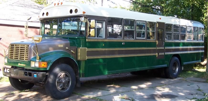
And once we got back, it was still pretty hot in and around the bus.  There was hardly a breeze, and even with all the windows and the roof vents open, it was hot.  We’d never encountered this level of heat and humidity (and Buffalo has plenty of humidity, but is pretty breezy), so I hadn’t thought to bring a fan. But I had wired the bus’ 12 volt accessories through a switch so that we could run them off the converter when we were plugged in (or batteries when we’re not) so I started up the big heater core fan and the two defrosting fans.  It worked pretty well.

The Star Wars Theme sounds pretty good on a dobro …

Later, as the sun was going down more, it cooled off as a little breeze started up.  Our son entertained us on his dobro, and I started getting a fire ready for dinner, while my wife made some potato salad and a green salad.

Beans warming up on (the edge of) the fire!

My contribution was to cook some burgers, and heat up some beans (in the can, of course) over the fire. The rotating, adjustable grating worked really well for being able to control the cooking, though

The burgers are about to come off the grill.

we started late and it quickly was pretty dark by the time the burgers were done, so it’s hard to see them well.  After a wonderful dinner, it was off to bed.  The Eclipse was the next day and we wanted to be ready.

(Continued in Part 7)


Our Eclipse Trip (Part 5)

(Continued from Part 4)

The view of woods to our east.

So, waking up at Fort Massac was nice, but warm and humid.  We spent the morning setting up and leveling the bus a bit with some pressure treated lumber under the back wheels.  But the site that we had was awesome.  We were on the edge of woods that spanned some 2 miles behind us, and at the end of a loop, so we had a grassy area next to our site on the south side, with a neighbor to the north.

An old park map showing the loops and historic fort sites.

We were at Site 36, which is on the farther loop from the river, but it ended up being more secluded and quiet, as the end of the first loop had a bike/hiking trail running right behind it.  Just at the end of our loop was a road that went to the old group camping area (no longer used) where we could get right on the bike trails.  (More about those later.)

The bus happily resting at Site 36 in Fort Massac State Park.

So, just on the edge of our site was the firepit, which is probably the most elaborate pit I’ve encountered so far.  Growing up in the Adirondacks, I was used to mortared stone firepits (almost fireplaces) with inset, hinged iron gratings.  Going to the Sprague Brook and Evangola parks, I got used to minimal steel rings with either a hinged steel grating, or one that had four different settings of heights, but never truly left the fire area.  The  firepit that we had at Allegany State Park was the most rustic, with just a ring of stones and no grating (And as such, we picked up a cheap grating at the camp store, which when it dies, we’ll replace with a more durable one – they’re good to have!).

The firepit for our site at Fort Massac.

But the firepit here was impressive.  The grill not only had a really nice handle, but was mounted on a post that allowed the grill to swing around to the back of the firepit, and then continue around to be back over the fire. The mechanism of it also allowed one (who was wearing gloves, so as not to get one’s hands all covered with rust, soot, and grease) to tilt the whole rotating arm so that the grill could be raised or lowered to the desired height above the fire for cooking.  This last was an important item, as I love to cook over the fire. The only downside what just how tall that steel ring was!  You’d have to be right on top of the fire to enjoy it.

Our site in the shade!

But when we arrived, keeping warm was the least of our worries. Temperatures were in the 80’s and 90’s with really high humidity.  Luckily, our site was one of the few with larger trees, so we had shade for most of the day, and with the grassy area nearby, when there was a breeze, we got that too.

When we got in the night before, we had stopped at the Welcome Center/Museum to check in, but it was closed.  After unloading the bikes, I rode over to the Welcome Center (which had AC!), and found out that for this park, we merely had to check in with the Camp Captain.  This was an easy thing, as we had reserved with ReserveAmerica and I had pre-registered and printed that sheet out, so all the data that was needed was right there. We also found out that the last fall, several trees had come down and the maintenance crew had cut and split them, and we could take 10 pieces of wood for free, which made the fire thing a whole lot easier.

Stone bifaces, points, and hand hoes from all across Illinois.

So, after setting everything up, we spent a little time checking out the park.  It was only about half a mile to the Welcome Center/Museum, and we spent a couple of hours looking at the collections. There were rows and rows of stone tools behind glass, and drawers and drawers of them as well.  The collection was from Quentin Richey, who drilled wells for many years, collected the artifacts starting in childhood and continuing over all over the places he worked, especially in Southeastern Illinois.  After his death, his family donated the collection (which had been on display in a local restaurant) to the state, so that more people could enjoy and learn from them.  It is a really impressive collection.

Yep, we found historic lead dice on display.

There were also artifacts from the historic forts that were built on the riverbank, as well as reproduction uniforms, and other items to replicate what everyday and household items from the time would have looked like.

Pioneer household items (actual artifacts and replicas) on display.


The Forts at Fort Massac.

The Fort of Fort Massac is actually two Forts, as mentioned in Part 1 of this adventure.

Southwestern blockhouse, large structure, and northwestern blockhouse, seen across the ditch that would have been between the double palisade walls.

The original French Fort is now merely earthworks, and the historic recreation of the American Fort that was built in 2002 had lost its palisade walls during the intervening years.  But the three blockhouses, two large structures (barracks and storehouses) and one smaller structure were standing, though locked and closed the whole time we were there.

The Eastern view from Fort Massac.

But with the view that one could get over the river, it was easy to see why this location was called ‘The Gibraltar of the Ohio’.  The rise on this side of the bank was easily 30 feet above the river level, and if guns were mounted in the blockhouses, they would have a significant range advantage over any guns mounted on watercraft.   Obviously a good location for maintaining control of who went past on the Ohio.

We also spent a little time biking our way over to the nearby McDonald’s.  This is way off our usual track for camping, but the McDonald’s was the closest source of wifi we could get (even as limited as it was).  We needed that as our son is learning Esperanto from Duolingo, and was on a streak of continuous days that he didn’t want to break.  As such, we went and bought an item from the dollar menu and got a cup of ice each day, while he used his tablet to do his work.  If the wifi was feeling agreeable, I was able to get a weather report, otherwise, I just got frustrated.

But our first day ended well.  We were settled, leveled, provisioned with wood, Duolingoed, and where we needed to be for the Eclipse in a couple of days. It was still hot and humid when we got to bed, but it cooled down overnight.

(Continued in Part 6)

Our Eclipse Trip (Part 4)

(Continued from Part 3)

The Wanderlodge behind us.

Now full of pizza and wings, we set off to find our way out of Butchertown.  Along the way, we were followed (and passed) by a beautifully kept Wanderlodge.  These are the ‘official’ company made RVs built out of school bus bodies (from 1968-2009).

The Wanderlodge heads off to parts unknown while we turn left. We had way more windows, though …)

As the Wanderlodge headed off on it’s own adventure, we made our way back onto the highway and over to the Bulliet Distillery.  The distillery is the only one in a rather industrial area just outside the city (map here) limits of Louisville as it was secured before the area was developed because of the availability of good water (and also to avoid paying taxes).  As it was, there were plenty of trucks and parking lots for heavy vehicles along the way.

One of the newer storage buildings.

The distillery was originally the the Stitzel-Weller Distilling Company  which was founded in 1935 with the combination of the distributor W. L. Weller & Sons, and the A. Ph. Stitzel Distillery.  Known for their ‘Old Fitzgerald’, ‘W.L. Weller’, ‘Pappy Van Winkle’, and other brands through 1972, when the distillery closed though the storage buildings continued to age barrels (at the height of it’s operations, the storage buildings could house 800,000 cases worth of bourbon).

Our tour guide walking us through the distilling process on a display of the facilities.

Bulleit was started (again) in 1987, and used some of the facilities at the Sitzel-Weller plant (though production other that R&D was moved before our tour – be on the lookout for a chocolate rye to be coming out in a few years!).

In the cooperage.

One of the cool things on the tour was seeing one of the few remaining historic cooperage buildings still with gear in it.  It had the facilities to empty a leaking barrel, remove the ends and bands, and allow the staves to be splayed, replaced, or leaks packed with rushes (rushes impart no odd flavors, it turns out).

A quick lesson on repairing a leaking barrel.
Quality control is first!

The highlight of the tour was the tasting. We tasted not only the regular Bulliet, but the 10 year-old, the single barrel uncut, the Rye Whiskey, and

some of the historic blend that’s being made with some of the orphan barrels that were left over when Bulliet took the space over.

But alas, it was over all too soon.  Though we did still have a drive ahead of us, and one of the things that I never seem to be able to do is get to a campground while it’s still light.  So, off we set for Metropolis.

And wound up in a traffic jam.  There were two accidents within a mile of each other and the multiple lanes of traffic were just crawling.

Finally we were in the clear and moved easily down I-65, until we hit the interchange with the Western Kentucky Parkway, which becomes I-69 near Morton’s gap. The interchange had a 15-20 minute stop-and-go traffic jam because of the merging with the Elizabethtown exits, but before we could get to that we had to climb the hill.

And the boy got plenty of reading done …

But once we got onto the Parkway, the engine was nice and cool, and we sailed along.  The Parkway runs nearly straight west, but with lots of hills, though none big enough to slow us down to shift into fourth.

Finally, we hit the end of I-69 where it intersects with I-24, which we took toward Paducah.  We got glimpses of the Cumberland and Tennessee Rivers, but it was starting to get toward evening and I had high hopes of getting to Fort Massac before dark. (I seem to have a hard time ending up at our campsite before dark for some reason.)

Looking west from the I-24 bridge over the Ohio River. Metropolis is just a few miles downriver.

But there was still some light as we got through Paducah and headed back across the Ohio River again and into Illinois.

Our exit was just past the bridge, and then it was only a couple of miles to our site.  Finally, we were at our location for the eclipse, safe, sound, and kind of tired!


(Continued in Part 5)