


(Continued from Part 4)

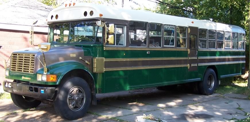
So, waking up at Fort Massac was nice, but warm and humid. We spent the morning setting up and leveling the bus a bit with some pressure treated lumber under the back wheels. But the site that we had was awesome. We were on the edge of woods that spanned some 2 miles behind us, and at the end of a loop, so we had a grassy area next to our site on the south side, with a neighbor to the north.

We were at Site 36, which is on the farther loop from the river, but it ended up being more secluded and quiet, as the end of the first loop had a bike/hiking trail running right behind it. Just at the end of our loop was a road that went to the old group camping area (no longer used) where we could get right on the bike trails. (More about those later.)

So, just on the edge of our site was the firepit, which is probably the most elaborate pit I’ve encountered so far. Growing up in the Adirondacks, I was used to mortared stone firepits (almost fireplaces) with inset, hinged iron gratings. Going to the Sprague Brook and Evangola parks, I got used to minimal steel rings with either a hinged steel grating, or one that had four different settings of heights, but never truly left the fire area. The firepit that we had at Allegany State Park was the most rustic, with just a ring of stones and no grating (And as such, we picked up a cheap grating at the camp store, which when it dies, we’ll replace with a more durable one – they’re good to have!).


But the firepit here was impressive. The grill not only had a really nice handle, but was mounted on a post that allowed the grill to swing around to the back of the firepit, and then continue around to be back over the fire. The mechanism of it also allowed one (who was wearing gloves, so as not to get one’s hands all covered with rust, soot, and grease) to tilt the whole rotating arm so that the grill could be raised or lowered to the desired height above the fire for cooking. This last was an important item, as I love to cook over the fire. The only downside what just how tall that steel ring was! You’d have to be right on top of the fire to enjoy it.

But when we arrived, keeping warm was the least of our worries. Temperatures were in the 80’s and 90’s with really high humidity. Luckily, our site was one of the few with larger trees, so we had shade for most of the day, and with the grassy area nearby, when there was a breeze, we got that too.
When we got in the night before, we had stopped at the Welcome Center/Museum to check in, but it was closed. After unloading the bikes, I rode over to the Welcome Center (which had AC!), and found out that for this park, we merely had to check in with the Camp Captain. This was an easy thing, as we had reserved with ReserveAmerica and I had pre-registered and printed that sheet out, so all the data that was needed was right there. We also found out that the last fall, several trees had come down and the maintenance crew had cut and split them, and we could take 10 pieces of wood for free, which made the fire thing a whole lot easier.

So, after setting everything up, we spent a little time checking out the park. It was only about half a mile to the Welcome Center/Museum, and we spent a couple of hours looking at the collections. There were rows and rows of stone tools behind glass, and drawers and drawers of them as well. The collection was from Quentin Richey, who drilled wells for many years, collected the artifacts starting in childhood and continuing over all over the places he worked, especially in Southeastern Illinois. After his death, his family donated the collection (which had been on display in a local restaurant) to the state, so that more people could enjoy and learn from them. It is a really impressive collection.

There were also artifacts from the historic forts that were built on the riverbank, as well as reproduction uniforms, and other items to replicate what everyday and household items from the time would have looked like.


The Fort of Fort Massac is actually two Forts, as mentioned in Part 1 of this adventure.

The original French Fort is now merely earthworks, and the historic recreation of the American Fort that was built in 2002 had lost its palisade walls during the intervening years. But the three blockhouses, two large structures (barracks and storehouses) and one smaller structure were standing, though locked and closed the whole time we were there.

But with the view that one could get over the river, it was easy to see why this location was called ‘The Gibraltar of the Ohio’. The rise on this side of the bank was easily 30 feet above the river level, and if guns were mounted in the blockhouses, they would have a significant range advantage over any guns mounted on watercraft. Obviously a good location for maintaining control of who went past on the Ohio.
We also spent a little time biking our way over to the nearby McDonald’s. This is way off our usual track for camping, but the McDonald’s was the closest source of wifi we could get (even as limited as it was). We needed that as our son is learning Esperanto from Duolingo, and was on a streak of continuous days that he didn’t want to break. As such, we went and bought an item from the dollar menu and got a cup of ice each day, while he used his tablet to do his work. If the wifi was feeling agreeable, I was able to get a weather report, otherwise, I just got frustrated.
But our first day ended well. We were settled, leveled, provisioned with wood, Duolingoed, and where we needed to be for the Eclipse in a couple of days. It was still hot and humid when we got to bed, but it cooled down overnight.
(Continued in Part 6)


