Tag Archives: Kentucky

Our Eclipse Trip (Part 9 – Mammoth Cave & Big Bone Lick)

(Continued from Part 8 …)

Mammoth Cave!

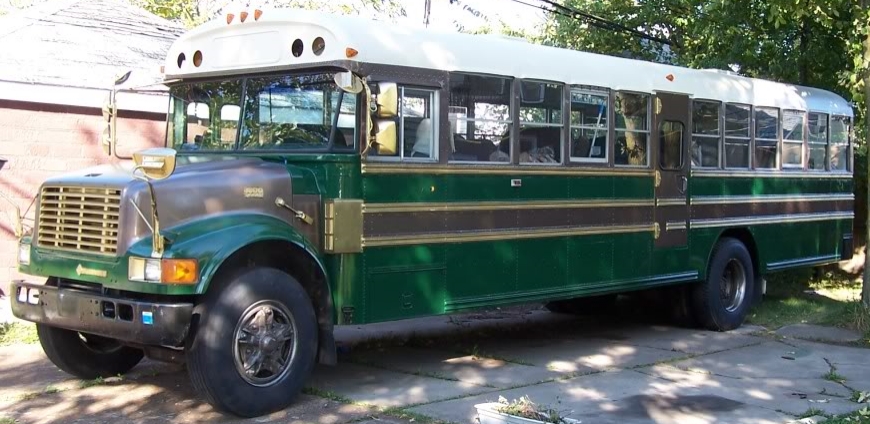
So, we finally made it along the narrow Kentucky roads to Mammoth Cave National Park.  The place was tucked back in some lovely forested hills, and the Visitor Center was very well attended.  So well attended, in fact, that there was only about 2/3rd of a single RV spot left to park in, as most of them were filled with cars!  As I parked in as tightly as I could, and went back to see if cars could get by. I wasn’t as happy as I could have been, but upon starting to walk to the Center, I noted that someone was heading for the bus, and it turned out they were moving the car in front of it, so I moved the bus up and was much more comfortably parked.

At the beginning of the path looking up toward the level of the Visitor Center.

We hit the well appointed bathrooms, then went to see about tours.  I had done some research on the tours, when looking at Mammoth Cave as a destination, but not about making advance reservations.  All but the self-guided walking tour of the shallowest, historic cave entrance tour were sold out! So, we got our tickets and made our way to the entrance, which was down a fairly steep path from the center.

The park is in south central Kentucky, and consists not only of the caves, but an area of the Green River valley (and hills around it).  The geology is a limestone ‘karst’, where the groundwaters seep into the limestone bedrock and erode it away, letting groundwaters flow deeper underground, sometimes creating underground lakes and destabilizing more bedrock causing rockfalls, or for the waters to find even deeper paths to follow.  These can create cave systems as waters flow to greater depths, and previously used in/outflows are left dry and unused by the water.

Mammoth Cave is the longest surveyed system, stretching more than 390 miles with potential for as much as a 1000 mile system.  This length is determined as having a way for a human to climb/swim through naturally existing openings, but not through active mining activities.

Heading down into the caves.

The historic entrance is where we entered, walking over a shoe cleaning pad (because of the white nose fungus that attacks bats) and then down a stairway to get us down into the caves. While this entrance looks massive, there are places just inside the baffle doors where it’s less than 6 feet tall and you have to watch your head.

Plenty of space.

But then you wind around a curve, and the whole thing opens up.  Quite a bit of the cave along through here was mined for calcium nitrate (saltpeter) during the War of 1812, but was later used briefly as a tuberculosis hospital, as well as a tourist attraction.

I’m in this picture for scale …

While we could only explore a small amount of the miles and miles of cave,  But that was kind of okay, as the cave was kind of chilly compared to the hot, sunny, summer day outside.  We chatted with some of the park rangers who were explaining about the caves and answering questions, and spent an hour and a half or so inside the cave.

Where the River Styx comes aboveground.

While the caves are the main attraction of the park, there are lots of trails that cover the hills too.  We spent some time walking further down from the historic entrance toward the Green River (which used to have a riverboat stop), where we turned aside to see where the ‘River Styx’ exits the cave complex at its deepest levels.

Our son said it was either named by a dog, or someone with a low sense of humor …

After some more hiking around and then climbing back up to the Visitor’s Center, we get back onto the bus and headed off to our stop for the night. It was a short trip on the smaller roads to get out to I-65, and then it was an easy trip to I-71, then another short trip on the smaller roads to get to Big Bone Lick, which we arrived at just before dark!

Some of a bison bison recovered from the salt lick.

Big Bone Lick is actually a place where salt deposits from the evaporation of an ancient sea are getting redissolved into underground springs which bring the saline water to the surface.

They have a friendly giant sloth at the museum.

Animals would come to the area to literally lick at the ground, but the moist soil in some areas would be like a quicksand that the animals ( including forms of bison, caribou, deer, elk, horse, mammoth, mastodon, moose, musk ox, peccary, sloth, and possibly tapir) who gathered could get mired in, and after they sank in, the salty soils could help preserve the bones from decomposition. Plenty of prominent people (like Lewis and Clark) came during the 1700’s & 1800’s for scientific investigation and study of the remains.

The campgrounds were pretty nice, with each site having electric hookups and every two sites sharing water hookups where we were. That said, there were rules about not washing dishes by the hookups or in the restrooms, so we took our dirty dishes with us, not having the plumbing tanks in place.

A nice view from the bedroom.

The sites backed up on some nice greenery, though some had some significant slope.  I used some 2x material to level us up. Just at the top of the hill, at the end of the loop, was a trail that led along to the Visitor’s Center/museum and the bison pasture.

Live bison, not fossils.

We spent some of the morning at the museum, and then watching the bison.  They have a nice-sized herd, with both adults and young.

It’s waffle time!

After this, we set off to make our way to Buffalo.  We did make a stop at a Waffle House in Ohio, but otherwise we made the trip in good time.  While it was (surprise) dark when we got home, we were back, and all worked out well for us on the trip – it was a success!

Our Eclipse Trip (Part 8 – The Long Trip Home)

(Continued from Part 7)

Huzzah for rain!

So, we spent another full day at Fort Massac after the Eclipse, and it was the day that the rain finally came and the heat and humidity broke. Most of the people in the campground also left that morning, so it was a nice quiet day.

We got in some bike-riding and wandering once things cooled down. It did mean that more bugs came out, but we had local volunteers helping us with that.

Our son found a painted rock that someone had left on the (now vacant) site just north of ours. It was really cute, and was a fun find that made our day just that much brighter.

You rock!
Keep or Hide. (We left it there.)
Down at Fort Massac’s boat launch in the evening.

Of course, the sun coming out again after the rain was nice as well.  We made it down to the river again, and walked down to get some Ohio River mud on our shoes.

Nice dramatic clouds in the sunset too!

But as nice as it was to have the cooler weather, we set off the next day fairly early (and as we’d filled up just outside Paducah, we had a full tank to start with) because we were off to hit Mammoth Caves!

A Kentucky Police Pick-up Truck?

It was a wonderful day for a trip, being sunny with some light clouds, and cool enough that I didn’t have to really worry about the engine’s temperature, even though our trip was mostly uphill!  We did see some interesting stuff on our way, though, like the Police Pick-up Truck.  In Buffalo (and as much of New York law enforcement that I’ve seen) SUVs and vans are the only real non-sedan light vehicles, so this was an oddity worth a picture.

The TVA Paradise Fossil Power Plant.

The other was the cooling towers of the TVA Paradise Fossil Plant.  Some research after the fact shows that this coal-powered plant,  located just east of Drakesboro, has the largest megawatt capacity of any power plant in the state.  We could see the plumes of steam really clearly from the Western Kentucky Parkway.

We stayed on the Parkway until we got to US231, which we took until we got to KY70, which really got me a bit nervous at first.  I didn’t mind the hills or the curves, but rather the fact that there was really no shoulder to these roads.  Meeting any kind of large vehicle was a sort of test of nerves of jockeying between the ditch and clipping someone’s mirror.  But it was some lovely countryside when there wasn’t any oncoming traffic.

And driving on these smaller roads would end up being great experience for getting to our campsite later that night when it was getting dark.

But finally, we made it to Mammoth Cave National Park. (Which I’ll discuss in Part 9.)


Our Eclipse Trip (Part 4)

(Continued from Part 3)

The Wanderlodge behind us.

Now full of pizza and wings, we set off to find our way out of Butchertown.  Along the way, we were followed (and passed) by a beautifully kept Wanderlodge.  These are the ‘official’ company made RVs built out of school bus bodies (from 1968-2009).

The Wanderlodge heads off to parts unknown while we turn left. We had way more windows, though …)

As the Wanderlodge headed off on it’s own adventure, we made our way back onto the highway and over to the Bulliet Distillery.  The distillery is the only one in a rather industrial area just outside the city (map here) limits of Louisville as it was secured before the area was developed because of the availability of good water (and also to avoid paying taxes).  As it was, there were plenty of trucks and parking lots for heavy vehicles along the way.

One of the newer storage buildings.

The distillery was originally the the Stitzel-Weller Distilling Company  which was founded in 1935 with the combination of the distributor W. L. Weller & Sons, and the A. Ph. Stitzel Distillery.  Known for their ‘Old Fitzgerald’, ‘W.L. Weller’, ‘Pappy Van Winkle’, and other brands through 1972, when the distillery closed though the storage buildings continued to age barrels (at the height of it’s operations, the storage buildings could house 800,000 cases worth of bourbon).

Our tour guide walking us through the distilling process on a display of the facilities.

Bulleit was started (again) in 1987, and used some of the facilities at the Sitzel-Weller plant (though production other that R&D was moved before our tour – be on the lookout for a chocolate rye to be coming out in a few years!).

In the cooperage.

One of the cool things on the tour was seeing one of the few remaining historic cooperage buildings still with gear in it.  It had the facilities to empty a leaking barrel, remove the ends and bands, and allow the staves to be splayed, replaced, or leaks packed with rushes (rushes impart no odd flavors, it turns out).

A quick lesson on repairing a leaking barrel.
Quality control is first!

The highlight of the tour was the tasting. We tasted not only the regular Bulliet, but the 10 year-old, the single barrel uncut, the Rye Whiskey, and

some of the historic blend that’s being made with some of the orphan barrels that were left over when Bulliet took the space over.

But alas, it was over all too soon.  Though we did still have a drive ahead of us, and one of the things that I never seem to be able to do is get to a campground while it’s still light.  So, off we set for Metropolis.

And wound up in a traffic jam.  There were two accidents within a mile of each other and the multiple lanes of traffic were just crawling.

Finally we were in the clear and moved easily down I-65, until we hit the interchange with the Western Kentucky Parkway, which becomes I-69 near Morton’s gap. The interchange had a 15-20 minute stop-and-go traffic jam because of the merging with the Elizabethtown exits, but before we could get to that we had to climb the hill.

And the boy got plenty of reading done …

But once we got onto the Parkway, the engine was nice and cool, and we sailed along.  The Parkway runs nearly straight west, but with lots of hills, though none big enough to slow us down to shift into fourth.

Finally, we hit the end of I-69 where it intersects with I-24, which we took toward Paducah.  We got glimpses of the Cumberland and Tennessee Rivers, but it was starting to get toward evening and I had high hopes of getting to Fort Massac before dark. (I seem to have a hard time ending up at our campsite before dark for some reason.)

Looking west from the I-24 bridge over the Ohio River. Metropolis is just a few miles downriver.

But there was still some light as we got through Paducah and headed back across the Ohio River again and into Illinois.

Our exit was just past the bridge, and then it was only a couple of miles to our site.  Finally, we were at our location for the eclipse, safe, sound, and kind of tired!


(Continued in Part 5)