Category Archives: trip

A Trip to Ohiopyle and Fallingwater (Part 1)

So, over the last weekend we traveled to Ohiopyle, PA, as a culmination of a class our son took in understanding architecture run by the education folks at Frank Lloyd Wright‘s Fallingwater.

Frank Lloyd Wright's Fallingwater
Frank Lloyd Wright’s Fallingwater

The symposium ran on Sunday for the students who took the class (a bunch in our homeschool group here in Buffalo, and some public school students from around Pittsburg) to show off the houses that they designed and built, either in model form or electronically, got a tour of Fallingwater, and then our homeschool students got a series of four additional classes on Monday.

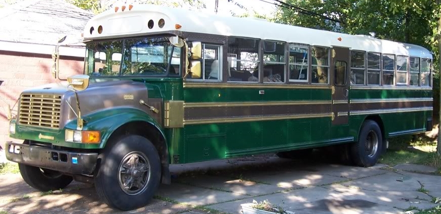
So this trip was going to be the longest trip we’d taken in the bus, as Ohiopyle (the nearest state park with camping to Fallingwater) is about 215 miles from Buffalo as the crow flies.  I thought that it would probably be best to travel via the shortest distance rather than taking expressways that went farther out of the way, and Google maps put together a route that made the shortest distance 272 miles.  This looked even more appealing as the route passed through the territory of the Seneca Nation of Indians near Salamanca, where diesel was just over $2/gallon.

The short trip route.

The route was calculated to take 5 hours and 50 minutes, but, as so often happens, it took longer.  We got out late, and as direct as that route looks on the map, it’s full of twists and turns and lots and lots of hills.

And of course, the bus has a manual transmission.

It ended up taking us 7 hours to get to the campground, more than half of that in the dark, and without high beams on, the headlights only show a short amount of the road ahead. We did drive through Pauxsutawney, and saw one of the Phil Statues (like the Herd About Buffalo) in a parking lot we paused in.

We passed over two (probably scenic) summits along the way, and we were limited to being in 3rd gear going up and fourth going down (with heavy stab braking), along with a myriad of smaller hills along the way.  The lowered speed limits, reduced visibility, and gearing/power limitations of keeping the bus at a safe speed and still making forward progress all added up to our getting in late. My shoulders ached from all the shifting with my right arm and managing turns with my left.

But checking in at the Ohiopyle State Park Campground was painless, even though we were late.  They had out a clipboard with a listing of all the sites, those reserved/occupied and the ones that were available, so that people could check in or ‘take’ an unoccupied site and settle accounts in the morning.  I circled our reservation, and we made our way to the site.

As nice a site as it was, I needed to turn the bus around before we could back in, and the campground map indicated that there was a loop at the end of the campground road we were on, so after checking out the site visually, we proceeded down the road – only to find that the loop at the end was not designed for a bus!  After some jockeying to make the first corner and lots of getting out to plan the next steps of getting past trees to continue forward we gave up, and I backed back around (again with several back and forths to make the corners and avoid other campers’ cars) and then up into the tail end of the dead-end road, and we were able to go back up the road in the direction we wanted to.  It is one of the times when I really thought I should have installed a switch to turn off the back-up beeper, and I apologized to the one camper who did stumble out to find out what we were doing …

After that, backing into the site was an easy task, and without leveling the bus, we made the bed (the boy had climbed into the bunk an hour or so before) and conked out for some much-needed sleep.

(Continued in Part 2)
Destination: Central(-ish) New York Locations of Geological Interest (to us)

nysparksCentral New York has a number of geologically significant sites, and some of them are places that we would want to go/be able to go with the bus.  Many of the areas are State Parks, rather than National Parks, as New York State started to preserve its own natural areas about the same time that the National Park Preserves were instituted (Yellowstone was the first in 1872).

Niagara Falls in an 1882 Lithograph

As proof of this, look to the Niagara Reservation State Park (protecting Niagara Falls, Goat Island, and ‘mainland’ areas adjacent to the Bridal Falls), which is the first State Park in America in 1885 (though legislation had been argued over since the late 1860’s)

A view of some of the Gorge at Letchworth.

Anyhow, the first place, going from west (Buffalo) toward the east, is Letchworth State Park, sometimes called the ‘Grand Canyon of the East.’  This is a State Park with camping near(ish) the Gorge Rim, and miles of hiking trails.

Falls and fall foliage.

With more than 14,000 acres of space, there’s three waterfalls,  including the tallest falls in the State.  There are historic sites, like Mary Jemison‘s gravesite and the restored Seneca Council House, and the Glen Iris Inn.  There are plenty of winter activities too, but the camping sites aren’t open then, so it’s a day-trip for those.

Some of the cool stonework-lined walking trails through Watkins Glen.

Watkins Glen State Park  is another really scenic location we’d like to hit. The narrow gorge has several levels of trails, from right down by the water, to much farther up along the rim of the gorge with more view.  Run as a private park and resort from 1860, it was purchased by the State as a public park in 1906.

More of Watkins Glen

The gorge itself is as much as 400′ deep, and has 19 waterfalls, making it a continually visually enticing hike.  Unfortunately (for us), while they have almost 150 RV/trailer spots (and many more camping sites) that will fit a 30′ or smaller unit, our 35′ bus is too large to stay there.

Chimney Bluffs formations


The third place is Chimney Bluffs State Park, which I mentioned in a previous post. There’s no camping here, but the Lake Bluff Campground is only a mile and a half away.

Taughannock Falls
Taughannock Falls

Taughannock Falls is another camping spot, though there’s only one (1!) site that would fit a 35′ RV, so book well in advance!  There are actually two falls within the park, and the creek flows along through the park to the shore of Cayuga Lake (one of the Finger Lakes) where they have a boat launch and beach!

the-salt-museumWhile not as geologically scenic as the other locations, the Salt Museum, in Liverpool, NY examines the history of the industry the salt springs along the shore of Onondaga Lake allowed, so productive that Syracuse, NY was known as the ‘Salt City’.  These springs of brine were slowly leeching away the salt from huge underground domes of salt evaporates from ancient seas.

Herkimer Diamonds in a cavity 'cache'.
Herkimer Diamonds in a cavity ‘cache’.

Farther east, the ancient seas also produced Herkimer Diamonds, pointed, faceted quartz crystals of high clarity.  There are two highly productive ‘mine-your-own’ mines right next to each other in Middleville, each with camping available.

People mining out Herkimer Diamonds
A cleaned up Herkimer Diamond.

The Ace of Diamonds Mine  has what seems to be a no-frills camping site and the Herkimer Diamond Mines is affiliated with the KOA thst is just across the road from it.  You can bring your own (non-power) mining tools, though the fee to get in to the Herkimer Diamond Mines gets you the use of a rock-hammer.  Closed shoes, durable pants, and eye-protection a must!

Howe Caverns
Howe Caverns

And lastly, Howe Caverns, its nearby rival of the Secret Caverns, and the relatively recently re-opened Cave House Museum of Mining & Geology.  Near Bramanville, the lower limestone bedrock has been eroded by water in places, making it pitted with cave networks, both large and small.

The signs for the Secret Caverns are all really awesome.

Some of the tours of Howe Cavern are undertaken by boat along flooded caves, while the Secret Caverns boast an underground waterfall (which depends on seepages from a swamp above for water – if you go during a dry spell, the waterfall may not be very impressive).

Tour boats 150 feet underground ...
Tour boats 150 feet underground …

And don’t think you need to spend all your time underground. Howe Caverns has also added a Zip-Line, Bungee, Climbing Wall, and High Ropes course, so you can really make a day out of your stay.  There’s a convenient RV campground just a few miles to the east in Central Valley, Hide-A-Way Campsites.  They have 60 spots, and look to have nice amenities.

I’ll be making another post about the Historical sites we want to go to, which will cross with some of these locations, making Central New York really rich and complex for our trips.

Destination/Trip: From Buffalo to the Almanzo Wilder Homestead

One of the destinations we want to go to with the bus is the Almanzo Wilder Homestead,  in Malone, NY.  On first glance, you might be asking ‘who’ and ‘why’, but this is the farm that Laura Ingalls Wilder’s (of the Little House books) husband grew up on before moving west and meeting her.

Now, not only is that a neat destination, but the trip there should be lots of fun.  Starting from Buffalo, our first likely stop is up on the Tonawanda Indian Reservation to top up our fuel for the trip.  While this seems like it would take us out of our way to Malone, it puts us right by the start of the ‘Cobblestone Trail’.

Located along historic Ridge Road (NY 104), the route follows the dry areas of the geography of one of the terraces of the Niagara Escarpment, just north of the route of the Erie Canal.  Used by pioneers and homesteaders in the 18th & 19th centuries, it was the major ‘northern’ route into Western New York.

These buildings, often built using skills of masons who had been brought in to work on the building of the stone aspects of the Erie Canal, were expensive and durable, being made of cobbles left from the retreat of the most recent ice age’s glaciers.  They functioned not just as houses, churches, or workshops, but also as status symbols for the communities they were in.   Now, there’s a Museum for the Cobblestone Society comprised of three cobblestone buildings and four more 19th century wooden structures (at 14389 Ridge Road in Albion).

Farther along, north of Rochester, NY Route 104 crosses the mouth of Irondequoit Bay on a long, elevated bridge that gives a great view of both the Bay and out to Lake Ontario to the north.

Following along NY 104 to the east, just past Sodus Bay, is Chimney Bluffs State Park.  Another remnant of the glacial actions of the last ice age, the eroding glacial till is constantly changing, like the Badlands of South Dakota.   These formations continue to the east along Lake Ontario to Oswego.

Following NY 104 along that route, past Oswego, 104B heads northeast to Route 3, which heads north along the eastern shore of Lake Ontario to Henderson Bay, and just past Sacketts Bay, heading north on County Road 180 to 12E, which will take us up to Cape Vincent, where Lake Ontario flows out into the St. Lawrence River and through the Thousand Islands.  NY Route 12 ends at Morristown, but the route along the river continues as NY Route 37, and continues that way until Massena.  After Massena, the road turns south-east toward Malone.

Just ten miles short of Malone (and twelve miles from the Almanzo Wilder Homestead) is the Babbling Brook RV Park.  This looks like a great base to travel from to the Homestead.  There are only 57 sites, but a quick search for reviews comes up nicely positive, so we’re looking forward to trying them out!

Finally we can get to the Homestead itself.  The museum/home-stead consists of 84 acres of farmland, woods, restored original post and beam constructed farmhouse (1840-1843), reconstructed post and beam framed barns and outbuildings, a museum/visitor center/research library/ archives/gift shop complex, orchard, covered picnic pavilion, and nature trail to the Wilder family frontage on the Trout River.

We really think that this looks like a full day’s worth of exploration, so we’ll likely have another night at the RV Park, then head home.  While the scenic route could take us 8 or so hours (without extended stops!), the route back to Buffalo, via I-81 and I-90 could take us as little as 4 and a half.  But of course, there’s more to do on the way back if we go in a round-about fashion.  But that’s another post’s work.

And if you want to know more about Almanzo Wilder, or what the homestead was like when he was a boy, check out the book!