Tag Archives: camping

Our Eclipse Trip (Part 1)

The total solar eclipse of August 21, 2017 was the first one that we would be able to get to and view.  Buffalo had an annular  eclipse (the moon is farther from the Earth, producing a ‘Ring of Fire’) in 1994, but it was too overcast to see, and the previous visible total eclipse was in 1925!   So we had planned for this for a couple of years to get the right place to be to see it well.

http://wivb.com/2017/08/21/look-back-walter-cronkite-covers-the-1979-eclipse/

I had scoped out the Dixon Springs State Park in Illinois as a nearly perfect place to stay.  It was about midway between the point of maximum coverage and maximum duration.  I emailed back and forth with one of the park officials who identified the best sites to fit our bus, and let me know that the site reservation window would open on January 1, 2017 for the August reservations.

However, when I logged into ReserveAmerica to grab one of the sites, I found them ALL booked.  It turns out that the state of Illinois had decided to capitalize on the eclipse for tourism, and had rolled their reservation window back to November and promoted their state sites!  Scrambling a bit, I found the Fort Massac State Park, adjacent to Metropolis, Illinois.

French Fort De L’Ascension/Massac on the left and reconstructed American Fort Massac on the right.

Fort Massac was originally founded by the French in 1757 as Fort De L’Ascension, and was rebuilt and renamed Massac during the end of the French and Indian War.  While the British nominally owned the territory afterward, the fort itself was burned by the local Cherokee by the time the British got there.

Reconstructed American Fort Massac (minus the log palisades).

The Americans got into the act when General George Washington ordered the fort reconstructed in 1794, and for the next 20 years it served as a military post, sometimes called the ‘Gibraltar of the Ohio’ due to it’s elevation and view of the river. Notable figures of Merriweather Lewis and William Clark camped at Fort Massac in 1803 as they made preparations for their Corps of Discovery expedition to the newly purchased Louisiana Territory.

The sign says it all …

Metropolis was laid out as a formal town in 1839, and it was hoped that it would be a transportation and commerce hub. It is now a city of about 6000 people, and is best known as the home of Superman (this is official, both from DC Comics and the Illinois State Legislature!).


A tiny fraction of the stone tool collection at Fort Massac.

As we were to find out, the Fort Massac Visitor Center there is mostly museum! They have a great collection of native american stone artifacts (from all over Illinois), and French and American artifacts recovered from the forts.

But most important for me was the fact that Fort Massac was still within the band of totality for the eclipse, and was only about 16 miles from Dixon Springs, so we wouldn’t lose much (about 10 seconds of totality) from being dead-center along the eclipse line. Within a few minutes, I had a site chosen and booked.  We had a place to camp for the eclipse!

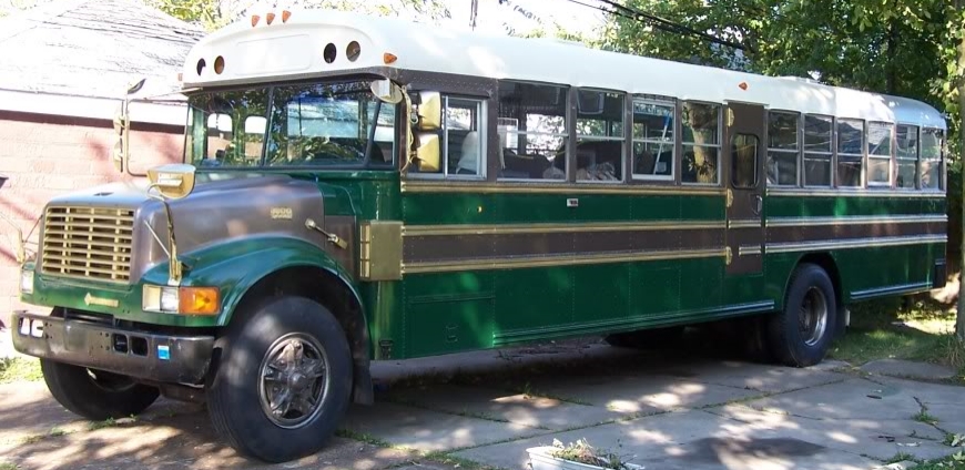
Then we had to get there.  The longest trip that we’d taken the bus on was from Buffalo to Ohiopyle, PA (Part 1, Part 2, and Part 3) and back which was a measly 600 miles or so.  This was going to be some 1600 miles, so it would be our biggest foray to date.

Our (rather grainy) route map for the Eclipse Trip

We had limited time to make the trip, and decided on a few key places to stop on our trip.  We had some friends in Cincinnati, OH who we could stop and see, the Embroiderer’s Guild of America Headquarters were in Louisville, KY, as was the Bulleit Bourbon Distillery tour (at the historic Stitzel-Weller Distillery), all on the way to Fort Massac.  On the way back, we could stop at Mammoth Caves and Big Bone Lick (where we could camp for the night).

With all this planned out, the next thing was packing and provisioning the bus. And then, of course, setting out on the journey …

(Continued in Part 2)


A Rochester Trip

So, we had to go to Rochester, NY for the Science Exploration Day that St. John Fisher College hosted.  As we needed to be at the college campus at 9:00 for registration, as our son was going as part of a group of Rochester homeschool kids, and thus we could beat the crush of buses bringing in regular school kids.

We briefly looked at hotels to stay in overnight, as it’s an hour and a half drive from Buffalo, but even with the College discounts at local places, it was still pretty expensive.  Given that, I of course took a look for campgrounds.  And, only 20 minutes away from St. John Fisher College, I found Webster Park, which has some areas of shoreline on Lake Ontario.

The campground itself has 45 sites and is nestled back about half a mile from the shore, surrounded by light to heavy woods for all but the big motorhome sites.  All the sites have electric, and while only five have dedicated water, there are enough taps throughout that about the farthest you’d have to walk for water is two or three sites.  While the price per night was higher than we’d payed for any of the Erie County or State sites we’d been to, it was certainly worth it compared to the hotel costs (and proximity to Rochester and Lake Ontario probably causes a lot of demand for sites).

So, even with the bus still having the hot start fail, we decided that it would be a short enough trip that we wouldn’t need to stop the bus unless we were in a place where it could sit and cool before we needed to go again.  We would start in Buffalo and get to Webster Park, then stay overnight. Then we would go from Webster Park to St. John Fisher and shut the bus down for the classes.  Then, when we were ready, head out from the College and back home.

The trip to the park was fairly uneventful, though I did a horrible job of trying to stay out of the way of fast-paced cars on the Rochester expressways.  It seemed like as soon as I moved over into the right hand lane to travel at the speed limit, the lane was ending, becoming an exit-only, or the exit we needed was a left-lane exit.  And, for that I apologize to those inconvenienced drivers.

But some of the drive was wonderfully scenic, like on the Route 104 bridge, some 45 feet up over Irondequoit Bay.  We found the campgrounds with no problem, though the stretch of Lake Road from Bay Road to the park is a lovely twisty, hilly section that motorcyclists must adore.

Checking in at the park was simple – since I had printed out my email confirmation of our reservation, all they had to do was see that and we were set.  Monroe County’s reservation site was nice, as it give pictures of the sites as well as the electrical, vehicle/trailer length capabilities, and such.  From that, while site 19 and 21 looked big and easy to back the bus into, I ended up choosing site 15, as just down behind it was East Creek, and I thought there would be a nice view downhill behind the site.

Site 15 ended up being even nicer when we got there.  It was easy to get the bus backed in, due to the curve of the loop at that point, and contained the end of a little geographical ‘finger’ so that at the north end of our site we could look down toward a swampy area, much like we could look down into a low valley to our east.


Down at the bottom of the ‘finger’ was a path that we could follow back along to the west and north, which brought us to the Kanatota Lodge which overlooks Lake Ontario.  It was a great sunny day to be there, with splashing waves and a nice breeze.  And the hike only took us about 10-15 minutes.

Part of the reason for a longer hike than it might seem for the distance was that there had been a windstorm that brought down a number of good-sized pine trees, so we had to pick our way around or over those.  But, since we could use fallen wood as firewood, we didn’t have to use any of our own wood for the fire.

We had a nice meal of beans (pre-cooked from dry at home), peppers, and tomatoes all cooked up in cast iron over the fire and some home-baked sourdough bread, and were joined by a dear friend who came up from Rochester to spend the evening with us.  Marshmallows were toasted (or burned) over the fire on the telescoping prongs’ first use, and scary stories were told in the red glow of the embers of the fire, accompanied by bourbon for those (adults) so inclined.

We cleaned everything up just as a thunderstorm rolled in, and we all slept well.  The temperature had dropped, so it was a bit chilly, and the sky was a little overcast after the storm, but the bathroom facilities were a warm, and we were able to set out on-time to brave the morning commuters along our route to the College.

I gave us an extra 20 minutes on top of what Google had suggested as travel time for us, and that all worked out – though again, I ended up facing the need to merge into a left-hand exit with rushing commuters doing the same.  My thanks to that pick-up who took pity on us and gave us space to merge!

The Science Exploration Day was a whirlwind of presentations.  The 40 minute presentations were followed by 10 minutes of trying to find the next one’s room.  Construction in one of the buildings, and different numbering directions in differing buildings made this a challenge, but our son got into some cool ones, and as I hung around outside the oft-packed classrooms, I overheard some good presentations.

We had parked in the back of one of the parking lots, and returned after the last presentation to our bus being surrounded by a myriad of national school bus chrome buses!  We stayed and ate some lunch while buses pulled out to pick up school kids, or loaded in the parking lots.  We got some looks, and had some homeschoolers come and take a look at our set-up.

One of the things we found was that the batteries for the linear actuator keychain remotes were dying or dead, meaning we only had one working.  But the batteries were easy to find, and replacing them was the job of a screwdriver and taking the keyring off, taking only a minute to do.  

After all the buses were gone, we packed up our lunch and headed out.  Our trip was a bit slower than our trip out to Rochester, as we got stuck behind … school buses dropping off students!  But we all had a great trip, and would be happy to go back to the Webster Park Campground.


Post Script: As far as the bus engine, it ran flawlessly, even for long periods.  And on our trip out, the ambient temperature was in the high seventies, and the running engine temperatures on the highway were approaching 200, and it didn’t falter.  I did try starting it hot at the campground after we parked, and it still hot failed. More on this later.

A Trip to Ohiopyle and Fallingwater (Part 3)

(Continued from Part 2)

After a quick breakfast of coffee and cereal, we packed everything up, put up the awning and headed off to Fallingwater.  While it was only about 2 miles away in a straight line, the campground was up atop a high ridge that we had to backtrack along to get down, and it ended up being an eight mile drive.

We also had to travel down PA 2010 (which was just one last long uphill drive as we were getting in so late on Friday night), which has a pretty steep grade for almost a mile of the mile and a half we were on it.  There was an option of going another route, but that would have replaced the 2010 route with a sixteen and a half mile detour.  I decided to just plan on stab braking my way down, and it all went fine.

We drove back through the town of Ohiopyle and along 381 North back up to Fallingwater.  The ‘campus’ has a couple of nice parking lots, one of which is set up for about eight RVs or buses, so parking was easy.  It was a chilly day, and the area the education people had for display space for the architectural models was in an outdoor area with a roof but no walls shielded from the parking area by some lovely evergreen trees.  That meant that while it was really comfortable out in the sun, sitting in the pavilion was kind of chilly.

Luckily, we had the bus right there and I was able to run back and get a sweatshirt for the boy, and then some coffee, and then a jacket.  The kids showed their models, and our son worked with staff to get their laptop to run Minecraft and load his world in, so he could show his. We then got to tour the Fallingwater house.

We couldn’t take an pictures inside the house during the tour, but let it be said that it certainly is a Frank Lloyd Wright house.  Low ceilings and corridors make you feel squeezed, and subconsciously make you move to more comfortable places in rooms.

After our tour, our son was able to give a tour of his house on the projector screen, but a couple other kids couldn’t get their digital data off their iphones, which was a bit disappointing.  But when it was all done, the kids were happy, the folks at Fallingwaters were impressed with what our homeschool group had done, and we went back to the campground.

Again, we took the steep shortcut and just rode it slowly.  All was fine.

Back in the campground, I turned the bus around at the intersection made by a utility (water & power) access road instead of trying the way-too-tight loop, and we slid right back into our spot. More Boss Monster ensued, and we had another chilly night.

The next morning we repeated the process of getting back to Fallingwater, but were delayed getting out of the town of Ohiopyle by a train.  While tempted to blow the train horn at them to get back at them doing so in the middle of the night near our camp, there were too many people around outside.

We arrived again at Fallingwater and over the day, the kids had some classes on architectural drawing & scaling, building paper cantilevers, and perspective drawing,  My wife found that the information area had these small little pieces of colored paper, each with directions on how to get where you were going from Fallingwater, so we grabbed one that confirmed how we would get to I-76.  Afterward, we said our goodbyes to the folks staying another night, made a quick dinner in the bus before leaving, ate, and headed back to Buffalo.

We had already decided that we would take the longer (but faster) route home, going back up 381 to 711 (and avoiding the shortcut that got us lost) to 31 and then onto The Pennsylvania Turnpike (I-76) West.  It was nice to see all the places we’d missed in the dark, and I had noticed when we’d passed over the Turnpike on our way down, so I had an idea of where we were going.

The Turnpike was it’s own adventure.  I’d never taken the bus on a toll road, and rather than having a manned toll booth, there was just a machine that spat out tickets.  As I was looking for a way to figure out what class we were, a ticket came out and, well, we were a class 3.  I guess there was a person watching somewhere. So, onto the westbound ramp we went, and I worked at getting up to traffic speed.

The speed limit was a zippy 70.

I can push the bus all the way up to 65, but that’s all the way up at 2600 RPMs, so I feel tenuous about holding it there.  So I rode us along between 63-65 while the trucks zoomed around us.  Some $17 later we got off the paid section of the Turnpike we had been on, and our exit onto I-79 North which would take us from Pittsburgh to Erie.

And again the speed limit was 70.

But we made it to near Erie and got on I-90 East, and I promptly got us off to get some fuel – just 10 gallons, as we were close enough to to the Seneca Reservation near Irving that I could fill up fully there, which we did.

Finally home!