Our Eclipse Trip (Part 2)

(continued from Part 1)

We planned out our meals, assuming that there would be days when it would be too hot to want to cook over the fire, but leaving room for a hot meal too.  My wife had shopped just before we left, and had looked for some steaks to take with us.  The store, however, had some ribs that were on sale (50% off!) so those were what came, along with some hamburgers, luncheon meats, hummus, snacking vegetables, cheeses, frozen pizzas, bagels …  The list went on.

The regular canned & dry goods pantry.

Luckily, our fridge is pretty big, and everything we wanted to take that needed to be kept cold fit.  We also had a bunch of canned goods, soups, beans, tomatoes, spam (of course), herring, you name it.  I usually keep a stock of those on the bus, but we added in some more soups and things.

By 11:00 am, we were all packed up, the house was secure (after being locked and alarmed and then me realizing that ALL my directions were sitting on the kitchen table!) and we started off. It was a pretty nice day, and after a quick weekend trip to Sprague Brook Park the weekend before (as a sort of shakedown trip) I’d filled the tank, so we were all set.

Except that the inverter wasn’t working.

Rolling farmland and countryside as seen from a moving bus …

I didn’t think it was a big deal, and we just kept going.  Along through New York on I-90, the speed limit was 65 mph, which is the top end for the bus, so that was fine.  It was a hot day though, and the temperatures kept creeping up over 200, so I feathered things a little to watch that.

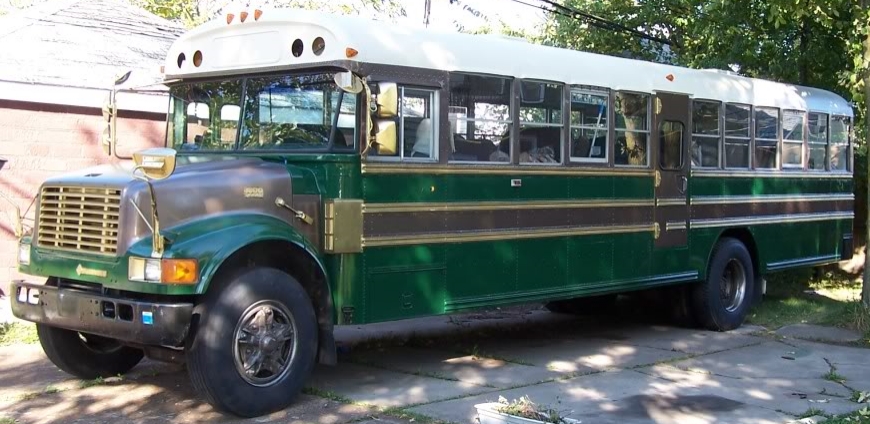
I was also watching the output from the backup camera that I had finally installed.  It does a nice job, the static lines on the screen indicating about 1′, 3′, 5′, and 12′ from the rear bumper.  It also has a large field of view as I mounted it just up above and to the side of the rear door. (It was a little odd at first though, as the 140 degree fish-eye picks up the break and signal lights!)  The screen is nice, because if I turn the power to the camera off with a handy dash switch, it goes to sleep until it gets a signal form the camera.

But I had plenty of time to get used to the camera and watching temperature gauge along in New York. The I-90 through Pennsylvania, though, had sections of the 90 that had a 70 mph limit, which meant that I was holding some of the trucks back (especially on some of the steeper hills where we lost speed).  I really felt badly about that, but we continued on into Ohio.

Which also had 70 mph speed limits.

And the hills got steeper, so our average speed dropped some more.

Many people don’t realize that there’s a major watershed divide in Ohio, and as we headed south from Cleveland, we were heading uphill toward that.  Using a really cool website called www.flattestroute.com, I’ve been to find out the grades of the possible routes that we’ve looked at to travel on.  The route from Buffalo to Cincinnati is interesting as we start out in Buffalo at about 600 feet above sea level, and end up at about 485 feet above sea level at Cincinnati, but hit altitudes of almost 1400 feet along the way.

North of the red line goes to the Great Lakes/St. Lawrence River, and south of it ends up in the Mississippi.
Altitude and slope of the route between Buffalo on left) and Cincinnati on right).

Just for interest, the first peak on that altitude graph is just east of Erie, PA (1259′), with the next lowest point being just east of the Pennsylvania/Ohio state line (677′), followed by the low point at the I-90 and I-271 interchange (648′).  The next high point was near Woodmere (1193′), but when we got to where 271 crosses the Cuyahoga Valley National Park it was lower (968′), only to rise again when we got to the Great Lakes-St. Lawrence River/Mississippi River Watershed boundary, just south of Medina, OH at about 1216 feet.  Then it was down again near Burbank (920′), and finally up to the highest point of our trip near Lexington, at 1391 feet, before our next low point just south of Lou Berlinner Park in Columbus (707′).  Another climb after we were out of the city brought us to the next high point at Exit 58 for Bowersville (1078′), then the next low near Mason, OH (762′), the next high point near Landon (871′), then finally the low of the Ridge Road Exit where we got off for the night (588′).

So, just looking at our starting and finishing altitude for our first day, we went down 12 feet, but if you look at even just the major high and low points along that day’s route, our ups and downs total some 5210 feet of altitude change!

And by the time we hit Jeffersonville, we were near a quarter tank of fuel, and decided to stop at a Love’s for fuel.  As per all of the travel stops that I’ve been to, I expected that the diesel pumps to be set for easier access for large vehicles, and away from the gas pumps.  Accordingly, Love’s has a banks of diesel pumps, and all the trucks are lined up right there, so I pull the bus in.  We wait for 10-15 minutes for the trucks ahead to fill, clean their windshields, and finally move ahead, and try to run our cards in the automated pumps.  Not a single one of them is accepted, they’re all declined.

I go through a minor panic, and my wife runs in to find out if there’s something wrong with the card reader.  And she has to wait on line for several minutes to find out that ALL of the pumps in those banks only take corporate cards, not regular credit cards.  If we want to use a regular card, we have to go to the one pump mixed in with the gas pumps that dispenses diesel. Which I was able to do.  And finally we got filled up and were back on the road.

Anyhow, we have friends who live not far from the Ridge Road exit in Cincinnati, so we got to drive down some lovely quiet little streets to get to theirs. We had talked about parking in front of their house on their dead-end street, but there were too many cars, and the exhaust pipe of the bus scraped about half-way up the slope of the entrance to their driveway, so backing in there didn’t work either.  So it was a multi-point turn (made much easier by the back-up camera) to turn around head the bus back out on their small street where we parked in the lot of a small apartment building at the end of the street that was in renovations (and our friends knew the manager who said it was okay).

We were treated to a great meal and a tour of their house (all the cabinets were hand-made by our friend Jeff, and they’ve stripped and refinished all the original woodwork, so it was great).  The rain which had been forecast for our trip had been spotty as we got close to Cincinnati, but really let loose once we stopped.  But at that point, it didn’t really matter, we were tired and ready to sleep.

But …

Without the inverter running (and since I don’t have the LP plumbed for the fridge yet), our fridge was a big cooler.  We had some worries, but there wasn’t much we could do right then, so we just left the doors closed.

The first day of the trip was done, and tomorrow would be a Kentucky day …

(continued in Part 3)


Our Eclipse Trip (Part 1)

The total solar eclipse of August 21, 2017 was the first one that we would be able to get to and view.  Buffalo had an annular  eclipse (the moon is farther from the Earth, producing a ‘Ring of Fire’) in 1994, but it was too overcast to see, and the previous visible total eclipse was in 1925!   So we had planned for this for a couple of years to get the right place to be to see it well.

http://wivb.com/2017/08/21/look-back-walter-cronkite-covers-the-1979-eclipse/

I had scoped out the Dixon Springs State Park in Illinois as a nearly perfect place to stay.  It was about midway between the point of maximum coverage and maximum duration.  I emailed back and forth with one of the park officials who identified the best sites to fit our bus, and let me know that the site reservation window would open on January 1, 2017 for the August reservations.

However, when I logged into ReserveAmerica to grab one of the sites, I found them ALL booked.  It turns out that the state of Illinois had decided to capitalize on the eclipse for tourism, and had rolled their reservation window back to November and promoted their state sites!  Scrambling a bit, I found the Fort Massac State Park, adjacent to Metropolis, Illinois.

French Fort De L’Ascension/Massac on the left and reconstructed American Fort Massac on the right.

Fort Massac was originally founded by the French in 1757 as Fort De L’Ascension, and was rebuilt and renamed Massac during the end of the French and Indian War.  While the British nominally owned the territory afterward, the fort itself was burned by the local Cherokee by the time the British got there.

Reconstructed American Fort Massac (minus the log palisades).

The Americans got into the act when General George Washington ordered the fort reconstructed in 1794, and for the next 20 years it served as a military post, sometimes called the ‘Gibraltar of the Ohio’ due to it’s elevation and view of the river. Notable figures of Merriweather Lewis and William Clark camped at Fort Massac in 1803 as they made preparations for their Corps of Discovery expedition to the newly purchased Louisiana Territory.

The sign says it all …

Metropolis was laid out as a formal town in 1839, and it was hoped that it would be a transportation and commerce hub. It is now a city of about 6000 people, and is best known as the home of Superman (this is official, both from DC Comics and the Illinois State Legislature!).


A tiny fraction of the stone tool collection at Fort Massac.

As we were to find out, the Fort Massac Visitor Center there is mostly museum! They have a great collection of native american stone artifacts (from all over Illinois), and French and American artifacts recovered from the forts.

But most important for me was the fact that Fort Massac was still within the band of totality for the eclipse, and was only about 16 miles from Dixon Springs, so we wouldn’t lose much (about 10 seconds of totality) from being dead-center along the eclipse line. Within a few minutes, I had a site chosen and booked.  We had a place to camp for the eclipse!

Then we had to get there.  The longest trip that we’d taken the bus on was from Buffalo to Ohiopyle, PA (Part 1, Part 2, and Part 3) and back which was a measly 600 miles or so.  This was going to be some 1600 miles, so it would be our biggest foray to date.

Our (rather grainy) route map for the Eclipse Trip

We had limited time to make the trip, and decided on a few key places to stop on our trip.  We had some friends in Cincinnati, OH who we could stop and see, the Embroiderer’s Guild of America Headquarters were in Louisville, KY, as was the Bulleit Bourbon Distillery tour (at the historic Stitzel-Weller Distillery), all on the way to Fort Massac.  On the way back, we could stop at Mammoth Caves and Big Bone Lick (where we could camp for the night).

With all this planned out, the next thing was packing and provisioning the bus. And then, of course, setting out on the journey …

(Continued in Part 2)


Storage and work space …

One of the things that’s super important in building a skoolie is to use your space wisely. We really worked to figure out our floor plan, and even that has changed as we’ve learned through trial, error, and working in the space we have.  One of the obvious changes is that we’ve eliminated the plan for the door between the galley and the bunks, and the other door and wall between the bunks and the ‘master’ bedroom area, which gives a more open, light- and air-filled space in the back.

But one of the things you just can’t change are those wheelwells. Well, I say that and I know there are people who cut them down, but I worry about bumps and the tires having enough travelspace, so that’s not an option for us, at least.

The driver’s side wheelwell was nicely covered by the bunks, leaving about 14 inches of space for underbunk drawers, but the passenger side one was only partially covered by the fridge, so I had built a framework to provide a flat space over it.  It took a while to get a piece of plywood on there, so the curved space with 2×3’s making a cage was a sort of catch-all space for small items to go so they wouldn’t slide around, while bigger items (like our water-cooler or folding chairs) could sit atop the cage and be bungee-secured to the wall along the fridge. (Not surprisingly, I don’t have many pictures of this.)

With some 1/2″ plywood atop the cage, the now-platform sat just below the seat-rail, some 19″ below the window.  My plan was to put in drawers, and after some discussion, we settled on two big drawers, rather than three or four smaller ones.  But without the little wall between the bunks and ‘master’ bedroom, there was actually some work-space possible, instead of just space to tuck things in, or stand off to the side so someone could get by.  In order to use that space, I decided to put in a ‘hidden’ wing.

The drawers are about 31″ by 23″ and just about 7 3/4″ deep.  The top surface, with the wing closed, is about 33×24″, covering the space over the wheelwell, and bringing it up flush with the base of the window.

While the main ‘dresser’ portion of this rests just over the platform and cage that surrounds the wheelwell, and the sides of the carcass are plywood (oak-faced in the aft-side), the raised panel side that faces aft runs all the way from the floor to the base of the windows, helping to hide the evidence of the wheelwell.

The raised-panel section houses two things – first, the threaded eyes that allow us to attach a bungee and strap in the folding chairs (and perhaps other things) just like we had done on the platform.  The second is the angled bit that some of you may have noticed in the picture.  It’s hinged with a couple of small steel pins to swing out and become a support for the wing!  A magnet set into the wing and #10 woodscrew in the side of the ‘dresser’ keeps it in place when not in use, and the fact that it’s only rounded on one side of the back allows it to swing, and stop when it’s perpendicular to the dresser.

The wing itself is some 3/4″ oak-faced plywood with some 1/4″ oak facing around the sides to hide the layers.  I put in a flat-fold brass finger-pull ring, so that it could be folded out or, conversely, left nice and flat depending on what we wanted to do.  The wing fits in really tightly into the surface of the dresser, making it almost hidden. Some brass middle hinges allow it to flip out into place.

This allows for a chair to be placed behind it and voila, a workspace with handy windows, and it’s out of the travel-lane.  When the awning it out, the emergency window can be propped open and even allow that wing to be accessed from outside (if you’re tall enough, that is).

A thing that could be overlooked in this is the fact that I’ve left the wall between the dresser and the fridge unfinished.  Granted, there’s a lot of unfinished in the bus, but this was actually intentional.  The space provided in the wall cavity serves as a perfect storage spot for long thin things, like our axe and hatchet (with the heads resting on the dresser surface), fire-tending equipment, supports for holding the emergency windows open, sticks for marshmallows, and a kid-sized cricket set (because of course we do).

We’ve just used this on a shakedown camping trip, and it got thumbs-up, so I was a happy camper!


Rebuilding a school bus into a rolling house.